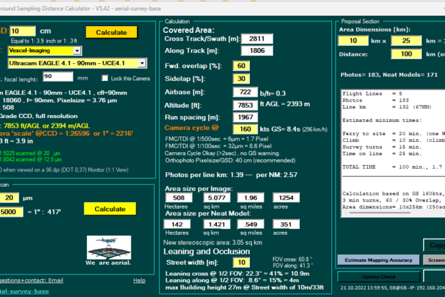
GSD Calculator 5.42 published including:
-
Vexcel Imaging Ultracam Eagle 4.1
Built on the proven UltraCam 4th generation architecture, the UltraCam Eagle 4.1 employs CMOS sensors for a finer pixel pitch (3.76), an industry-leading panchromatic image footprint of more than 28,000 pixels across the flight strip, and a rapid cycle rate of 1 frame per 0.7 seconds. The combination of high dynamic range, fast shutter speed and wide-aperture lenses gives customers the efficiency, flexibility, and image quality they need to succeed in today’s rapidly evolving market.
Vexcel developed the proprietary “Adaptive Motion Compensation” (AMC) software approach to address image blur. More than just forward motion compensation, AMC compensates for image blur caused by multi-directional camera movement during the flight.
Commercial availability of the UltraCam Eagle 4.1 is scheduled for end of 2022.
The first production camera has already been sold to Slagboom & Peeters Aerial Photography.
Key Specifications
- 28,110 x 18,060 pixels PAN image size
- 9,370 x 6,020 pixels color image size
- CMOS imaging sensors
- Adaptive Motion Compensation (AMC)
- 1 frame per 0.7 seconds
- 90 mm, 120 mm, or 150 mm user-exchangeable lens systems
UltraNav v7
Vexcel Imaging introduces the next version of UltraNav, its all-in-one Flight Management and direct georeferencing solution.
- 3D Flight Planning
- real-time navigation
- quality control during flight
- post-processing GNSS/INS data
Vexcel has entered into a new partnership with TopoFlight for flight planning/management and continues its longstanding partnership with Applanix for the GNSS/INS modules & post-processing.
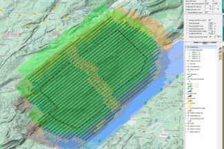
During 3D Flight Planning, UltraNav uses Digital Elevation Models for fast, interactive and cost-effective flight plan designs.
When in the air, the software manages camera parameter settings, exposure triggering and automated mount stabilization for precise ground coverage & image overlap.
Two displays for real-time navigation for the pilot and in-flight quality control for the operator support smooth and efficient data collection.
Back on the ground, industry-leading Applanix GNSS/INS post-processing software achieves both maximum accuracy and maximum efficiency for direct georeferencing.
The system is available with both 510 and 610 accuracy class performance levels based on the included ITAR-free Inertial Measurement Unit (IMU), which are fully embedded in the camera body.


