aerial-survey-base with its network of partners can mobilize an aerial survey & mapping team fast to any place in the world.
Our operations and training take us regularly to all continents and our expertise is based in the ability to operate effectively worldwide.
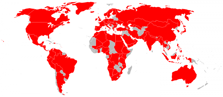
Together with our partner GeoConsultants Groups of Companies we provide latest aerial sensor technology to reduce the number of flight time and lower costs without sacrificing the quality of the product. The collection capabilities and geometric accuracy of our large format mapping cameras, such as Vexcel UltraCam and Leica Z/I Imaging DMC, are the start point to produce high quality DTM, Orthophoto and other photogrammetric products.
![LiDAR operation Kenya Massai LiDAR operation Kenya Massai](https://aerial-survey-base.com/wp-content/uploads/2017/01/02_international_operations_Kenya_Helicopter_Massai_250x200.jpg)
![operation Saudi Arabia Arabasco Rockwell Turbo Commander Aerocommander aerial survey aircraft AC690 Saudi Arabia Arabasco Rockwell Turbo Commander AC690](https://aerial-survey-base.com/wp-content/uploads/2017/01/04_international_operations_Saudi_Arabasco_250x200.jpg)
![HHongkong Lands Department HK, Hong Kong , Jetstream J41, B-HRS, Survey and Mapping Division Jetstream J41 aerial mapping aircraft, aerial survey airplane](https://aerial-survey-base.com/wp-content/uploads/2017/01/07_international_operations_survey_aircraft_250x200.jpg)
![GCP Ground Control Morocco, GPS AERocontrol Applanix LiDAR, Base Ground Reference Station, المغرب Base Ground Reference Station, المغرب](https://aerial-survey-base.com/wp-content/uploads/2017/01/11_international_operations_GPS_Base_Morocco_250x200.jpg)
![AERIAL SURVEY BASE CLIENT GROUP MEETING NEW DELHI INDIA INDIAN AIRFORCE AERIAL SURVEY BASE CLIENT GROUP MEETING NEW DELHI INDIA INDIAN AIRFORCE](https://aerial-survey-base.com/wp-content/uploads/2017/01/01_international_operations_client_group_250x200.jpg)
![Ground Control Point GPS Trimble Tripod GPS Base Reference Ground Station CORS Applanix AEROcontrol Ground Control Point GPS Trimble Tripod GPS Base Reference Ground Station CORS Applanix AEROcontrol](https://aerial-survey-base.com/wp-content/uploads/2017/01/05_international_operations_Groundcontrol_1_250x200.jpg)
![Refueling aircraft Phillippines Refueling aircraft Phillippines](https://aerial-survey-base.com/wp-content/uploads/2017/01/03_international_operations_Phillipines_250x200.jpg)
![GCP Ground ControlDubai Municipality UAE, GPS AERocontrol Applanix LiDAR, Base Ground Reference Station GCP Ground ControlDubai Municipality UAE, GPS AERocontrol Applanix LiDAR, Base Ground Reference Station](https://aerial-survey-base.com/wp-content/uploads/2017/01/09_international_operations_Groundcontrol_4_Dubai_250x200.jpg)